Tuesday, August 31, 2010

Opal Wildfire Update #21

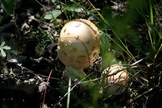
The blueberries are ready for the picking.  In the open meadows the wild asters are in full bloom, the white of the yarrow stands out from the blanket of purple created by the asters.  Around the fringes of the meadow the fireweed stands tall, its green leaves beginning to turn red.  Strings of fuzz hang where just days ago bumblebees visited red blossoms.

The coyotes are sleek and have interrupted their hunting for rabbits, mice and voles to fill up on blueberries.  Our lone bear no longer turns over rotten deadfall looking for ant eggs and other insects as now he too is loading up on these tiny blue delicacies.  The whitetail fawns are shedding their spots, young finch are busy devouring thistle seeds, Swainson's hawk fledgelings scream their displeasure at being left to hunt on their own and the moose calf has grown too tall to run underneath his mother's belly.  The two turkey vultures that have graced us with their presence over the last three summers have moved on to greener carrion.  In  their wake they leave behind an ugly white mess on their favorite roosting spot (the roof of my cabin).  The water lilies on the Ghost Horse Hills wetland are in bloom.  These are all signs that the summer of 2010 is winding down.  A time of maturity has come to the Halfmoon Lake Natural Area in the Ghost Horse Hills.

The work of Rainbow Equitation Society and the Nature Conservancy of Canada has successfully protected  this wonderful place through another season.  A huge debt is also owed to the firefighters and support staff that succeeded in stopping the Opal wildfire less than a kilometre from the Halfmoon Lake Natural Area.

As for Opal East Natural Area, the spring and summer rains have encouraged new growth.  Within the burn area the willows and aspens are working their way from the ground up some growing as much as a metre.  This rejuvenation provides hope but the look and the feel of the blackened areas is still overpowering.  With the growing season all but over we will wait for 2011 to see if the pine and other trees and shrubs follow the example of the willow and aspen.  The water levels in the bogs and wetlands are lower than I have ever known them to be.  A huge snowfall this winter would help raise the water levels.  A massive bush party at Opal East left soil rooted up and garbage in its wake.  The garbage will be retrieved but it will take generations to heal the land.  Opal East has been lost to the quads and dirt bikes.  It would be good if we could somehow assist our farmers and ranchers in the protection of their grazing leases at Opal -- fences are being cut, cattle harassed, forage destroyed and their livelihoods compromised.  The truth is that it is hard to help others when you are unable to protect your own interests (Natural Areas).

Bridge Lakes is doomed to the same fate as Opal East, Bruderheim and Redwater if something substantial isn't done and soon.  Fortunately, the other Natural Areas in our zone have been left largely undamaged.  Progress on management plan suggestions is being made.  God willing it will be ready to present in late November after municipal elections.  In the past there has been a poor job of communicating land use concerns about our special areas to local officials.  This has led to some tragic decision-making with the Clyde Fen being an example.  A poorly thought-out road easement has cost the province one of its best and most studied fern groves.

On the upside, the Athabasca Landing Trail Steering Committee serves as a shining example of what can happen when local government and interest groups share information.  Working together with provincial departments and not-for-profit groups, this committee has been able to complete a master plan for the Athabasca Landing Trail, construct a beautiful bridge over the Redwater River and set the tone and direction for future planning within the boundaries of the 100-mile Portage.  This type of cooperation is what will be needed if we are to establish a linear park and recreation area linked by the Athabasca Landing Trail.

Eagle Point Blue Rapids has been put forward by the province as a model for the type of parks that our government would like to see created for Albertans.  Work is being done to put forward a second model for the development of new parks in Alberta, that being a linear concept connected by recreational trails and road systems.  The job is to promote this concept to local governments and the province.

The high point for me this season was to learn of the interest that exists for the protection of the three small rivers that parallel the Athabasca Landing Trail.  I know of no better way to protect the waters that flow into these rivers than to ensure the health of the lands that make up their basins.

I look forward to the fall colours of the Ghost Horse Hills.  The cycle of changes is never-ending.  Right now it's time to pick blueberries, something I did on Saturday with Noah my three-year old grandson.  We picked only about a half of a tin cup -- mostly I picked, Noah ate.

Richard


 Fledgeling Swainson's Hawk


 Thistle gone to seed -- food for the finches


 Lilies on the Ghost Horse Hills wetland


New poplar and willow growth on the Opal Natural Area


One of several dunes at Opal left bare by quad & dirt bike activity


 What can you say


 Pops & Noah walking through the asters looking for blueberries

Opal Wildfire Update #20

"Eventually all things merge into one -- and a river runs through it.  The river was cut out by the world's great flood.  Its waters run over rock dug out of the basement of time.  I am haunted by waters."
- from the movie A River Runs Through It

Before their move to San Diego my youngest son Luke and his wife Clara wrote movie reviews -- a 'he said, she said' column for See magazine.  Everyone in our family enjoys a good movie although our tastes vary greatly.  Being that Luke gets paid for his opinions about movies, he thinks that his taste should be more developed than say mine.   For example, my all-time favorite movie is A River Runs Through It directed by Robert Redford.  This is a choice that Luke has trouble appreciating; I think that may be because he is not yet old enough to have experienced many rivers in his life.  On the other hand, I have been blessed with an appreciation of three extraordinary waterways -- the Sturgeon,  Redwater and Tawatinaw Rivers.

These rivers do not carry great volumes of water nor are they long in their length but their effect on the country that they pass through is enormous.  The Sturgeon enters the county that bears its name from the west.  It bends to the southeast at Battenburg Crossing before it enters the big river across from the city of Fort Saskatchewan.  The Redwater River's northern arm begins at Bridge Lakes.  It winds its way south by southeast before it too empties into the North Saskatchewan.  Just six miles north of the Bridge Lakes, the Tawatinaw River has its beginnings in the Rochester Everglades.  The waters move south out of the everglades by way of Stony Creek.  At the Tawatinaw ski hill this waterway becomes the Tawatinaw River.  It flows straight north for the next 40 miles until it enters into the Athabasca River.

The Athabasca Landing Trail travels almost straight north from where the Sturgeon River meets the Saskatchewan.  For the next hundred miles the old trail zigzags its way up to the town of Athabasca never very far from one of these three rivers.

Along the banks and within the basins of these rivers are thousands of acres of untouched lands -- Natural Areas, bogs, muskegs, crown and undeveloped private land.  These natural spaces provide filtered water to these rivers and the result is spectacular.

Last week I set out to investigate a story I had heard about long lost gold coins on the banks of the Redwater River.  My detective work took me to a farm where I asked for permission to walk out to the back of their quarter section.

Before I knew it I had forgotten why I was there, distracted by rows of peas and carrots and by wild raspberries, saskatoons and other tastie goodies.  I watched as the field workers steadily and quietly went about their job.  A small creek had been dammed by a beaver and had created a beautiful pond.  A big fat beaver came swimming my way.  When he noticed me he slapped his tail and submerged.  He repeated this performance twice more before disappearing into his lodge.  Mourning doves sprang up from the tall grass their wings squeaking as they made their getaway.  At an old long-abandoned building site, seed pods from the caragana hedges were making popping sounds as they exploded in the heat of the day.  As I approached the old barn a rock dove hooted a warning and flew off clapping his wings over his back.  The smell of the clover and sage was heavy in the air.

I was in paradise.  All of the tastes, sounds, sights and smells merged into one, creating an incredible feeling of peace and well-being . . . and yes, the Redwater River runs through it.

Thank you.
Richard


The Sturgeon River as it passes under the rail trestle at Battenburg Crossing on the Athabasca Landing Trail.


Bridge Lakes, the headwaters for the Redwater River.


A blue heron leaving the Tawatinaw River.


The Tawatinaw River with the town of Rochester in the background.


A very special beaver pond with lodge on a creek that empties into the Redwater River.


An old abandoned barn just downstream from the Redwater Bridge, home to pigeons, porcupines and I'm sure a weasel or two.


The Redwater River, August 2010.

Opal Wildfire Update #19

August 6, 2010

Hello everybody,

This information came to me yesterday.  I am forwarding it to you with an urgent request that you read through the news release and fill out the accompanying public survey.  It will  only take a few minutes of your time.

Should our elected officials be able to follow through with this proposal, I believe that it will be a bold and positive step towards preventing tragedies like the Opal wildfire and the type of destruction that has taken place at Bruderheim, Bridge Lakes and all over this province.  The possibility of permit access to our crown lands is the way of the future.  It will be just like buying a fishing licence (maybe).  The link to the government survey is at the bottom of the news release.

Once again, please fill it out and encourage all other responsible outdoor types that you know to do the same.

Thank you.

Richard


News Release 


August 5, 2010
Province seeks input on proposed regulation changes
Updated regulation a better tool to deal with abuse of public land
Edmonton... Albertans are asked for their input into proposed regulation changes being made to strengthen the management of public lands.

The changes under the Public Lands Act will allow the Alberta government to better manage general access to vacant public land, allow for stronger compliance and enforcement, and provide for appeals to ensure fairness and consistency in decision-making.
The changes provide the government with more ability to deal with the offenders who abuse public land. For example, government may be able to temporarily close an area to prevent loss or damage to public land from off-highway vehicle riders who drive through sensitive wet areas.
Public consultation is a key step in the process to develop the new regulations. Albertans are invited to complete an online survey regarding the proposed regulation changes at http://www.srd.alberta.ca/Newsroom/SRDSurveys/Default.aspx or mail in a completed survey to:
Legislative Services Unit, Sustainable Resource Development
2nd Floor South Petroleum Plaza
9915-108 Street
Edmonton, Alberta
T5K 2G8
Feedback must be submitted by 4:30 p.m. on September 17, 2010, to allow time to evaluate the submissions. Public comments will be reviewed and considered as the regulations are developed.

Opal Wildfire Update #18


August 2, 2010


pastedGraphic.tiff


Davy
        Davy Crockett
King of the wild frontier

Most baby boomers will recognize those words as part of the theme song from the 1950s TV series 'The Adventures of Davy Crockett'.  The part of Davy Crockett was played by Fess Parker.  Mr. Parker also played the part of Daniel Boone another American frontier hero.

On March 18, 2010 Fess Parker passed away at the age of 85.  In so doing he joins the likes of Roy Rogers, Rex Allen, Gene Autry, Audie Murphy, John Wayne and other 1940 & 50s actors who played the part of cowboys and mountain men on the TV and silver screens.

On the TV or at the Saturday matinees in movies like 'Old Yeller', 'My Friend Flicka', 'Green Grass of Wyoming', 'Jeremiah Johnson' or 'The Searchers' -- 'My Heroes Have Always Been Cowboys' (thanks for the song Willie).

The quiet freedom and adventure depicted in the open spaces of these old dusters were what most appealed to me.  It is those movies that first drew me to the outdoors and the world of nature.  It is the experiences that I find there that bring me back to the land and the trails that intermingle along the Athabasca Landing Trail.  Throughout the Ghost Horse Hills and on the Opal, Halfmoon Lake and Bridge Lakes Natural Areas there are trails that have seen human use for over 150 years.  As I hike or ride my pony over these trails I see myself back with the Chipewyan, Wood Cree and the Métis or as one of the men with the Hudson's Bay or Northwest Trading Companies.  I see myself alongside men like Radisson and Groseilliers, Anthony Henday or with David Thompson and his wife Charlotte. . . or  with John Gullion.

Who is John Gullion you ask?  In my opinion, one of the greatest frontier heroes anyplace, anytime.  And one of history's best-kept secrets.  In most records, John's name appears only in passing. . . as a footnote.  But as you filter through the records, his name appears over and over again most often as part of a long list of other names.  These lists soon start to paint a picture of what the man was -- a hunter, trapper, fur-trader, guide and interpreter for the NorthWest Mounted Police, a tracker of scows on the Athabasca River, a freighter on the Landing Trail, the first homesteader/farmer north of the Sturgeon River, a businessman operating a stopping house and Captain of the sternwheeler Grahame.  He played the fiddle, was known as a notorious prankster and in his spare time he built river scows (otherwise know as 'sturgeon-heads').

The Gullion homestead is just four miles north of the Redwater Bridge on the Athabasca Landing Trail.  There is not much left of the site.  The school named after Gullion is gone.  All that remain are the land and the open spaces that were the backdrop to the John Gullion stories.

In the Davy Crockett song there is a line that states that 'Davy killed his first bear when he was just three'.  Such is the way of oral storytelling.  Dozens of stories about John Gullion still circulate and if they're not all true they should be because they're just too good to stop telling.  There's enough stories to make a movie with a theme song of its own like:

pastedGraphic.tiffJohnny
Johnny Gullion
King of the Landing Trail.

Okay, so I'm not Ian Tyson, David Archibald (or Willie Nelson for that matter), it's the thought that counts.

Thanks.

Richard
(Scroll down for pictures)

A string of river scows on the Athabasca River.  Take note of the guys on the bank with the rope in their hands.  They are pulling (tracking) those scows upriver.


The steam-powered sternwheeler 'Grahame' that John Gullion captained.


This section is part of a trail that went from the Landing Trail at Halfmoon Lake to the Victoria Trail at the Vinca Ferry.  It is at least 120 years old.


Wetland picture taken from the shoulder of the Athabasca Landing Trail.


Another wetland picture taken from the shoulder of the Athabasca Landing Trail.


Where a stopping house with two huge barns once stood.  This is what is left of the Gullion homestead.


Opal Wildfire Update #17


"It calls back, its pull is stronger than ever -- it whispers its fairy magic to the ears and its memory disturbs the mind."
- Jawaharlal Nehru, 1st Prime Minister of India

Nehru was speaking about Kashmir (a province in India); it could just as easily be said of the area along the Athabasca Landing Trail.

Those who have been blessed with a knowledge of the area believe that there is a magic to be found here. Given that my wife and I live on Fairydale Road and less than 3 kilometres from Fairydale Creek with the Fairydale wetlands a little further to the north, it might be that there is a little 'fairy magic' at work in the area.

At whatever point you enter into this 100-mile portage, that's where the world ends and paradise begins.  From the landing at Ft. Saskatchewan to the landing at Athabasca everything is magical.  The natural and human history is so interwoven that one is incomplete without the other.  If we are talking about the beauty of nature that exists on the land then we must also talk about the Trail for it is the Trail that brings us to the view of God's creations.  If we talk about the Trail then we must talk about the people that traveled the Trail, past and present.

No better place to start than with the ghosts of the Redwater Bridge.  Personally I do not believe in ghosts; I have never seen one or felt one's presence.  That aside, I have neighbours that swear they do exist and that they have seen them.  What I do know is that there are several unmarked gravemounds along the sides of the old Athabasca Landing Trail.  As for the ghosts of the Redwater Bridge, they are said to be the wife and youngest daughter of Joseph Delorme.  

Old Joe was a Métis freighter who had squatted on some land just north of the Redwater Bridge.  Legend has it that Joe held the last spike for Lord Strathcona at the dedication of the CPRs rail-line to Edmonton.  Joe would leave on some long freight hauls, loading in Edmonton, stopping off at home before proceeding to Athabasca Landing and beyond.  Joe was in the habit of arriving back home around dusk.  Often his wife and youngest daughter would walk down to the bridge at that time of day in hopes of meeting him and riding back in the wagon.

One  early summer day while Joe was away on a haul, tragedy struck.  A wildfire swept through the area (just like the Opal wildfire of 2010).  The older children reached the river in time but the mother and youngest daughter were overcome by smoke and died on the Trail.  Nobody knows whether these two spirits are even yet trying to reach the river for safety or whether it is just Mom & daughter walking down to meet old Joe but through the years stories persist of sightings of the ghostly pair down by the bridge that crosses the Redwater River.

As I said, I don't believe in ghosts but just in case I'm wrong, I hope that the new bridge that looks like the old bridge of Joe Delorme's time is pleasing to these two.

This is the story as told to me by the man who married old Joe's granddaughter.

The following pictures show a little of the 'fairy magic' along the Athabasca Landing Trail and in the Ghost Horse Hills.

Thanks.

Richard


The Redwater River as seen through the timbers of the new bridge.


Looking north over the new bridge towards the site where the Delorme family had lived.

Opal Wildfire Update #16


July 19, 2010


Friends of the Geographical Names of Alberta' -- what a novel idea.  A Society whose purpose is to document the names of places in Alberta.  This society initiated a program they call 'Name Your Place'.  It's intent is to collect information and documentation about how places in Alberta got their names.

In the here and now (2010) this type of information is becoming increasingly harder to collect.  I suspect that this could be the result of the folks that gave the names not keeping proper records.  They probably didn't think that it was a big deal and I doubt that they ever held any stakeholder meetings to get public opinion.  Names were simply given as post office locations.

In Cree  'athabasca' meant 'place where the reeds grow'.  Back in 1874 the Hudson's Bay Company needed a trail north from Edmonton out to the place where the reeds grow (Athabasca Landing).  With a little planning and hard work the Athabasca Landing Trail came into existence.  Now some 136 years later that  name is legend with countless stories associated with the trail that became Alberta's first dominion highway and Canada's first toll road.

Names of other places came about in the opposite way.  They had to earn them.  First the history (reputation) then the name.  The Opal Natural Areas and grazing leases are part of just such a location.

The Opal area is like a big sponge.  Any moisture that falls in this area is soaked up by the many sand dunes and the huge muskeg bog.  The water is trapped, prevented from escaping downwards by an underlay of bentonite clay.  Moisture collected in this 4500 hectare sponge has only three ways of escaping -- by evaporation or by way of two small creeks.  When the water levels are high Dvorski and Copper Creek drain into a third creek before the water is emptied into the Redwater River.  It is this third creek that had to earn its name.

The truth is that this waterway really isn't much of a creek at all.  It's only ten kilometres in length with a total drop in elevation of less than a metre.  It has few flow zones.  Gravity does its job and pulls the water into the Redwater River just downstream from Bridge 246 (over the Redwater River on the Athabasca Landing Trail).

From where my wife and I sit on our front porch, 150 metres up the hill to the east is the site of the old Waugh School.  25 metres past the school site, paralleling the south to north flow of the creek, is the Athabasca Landing Trail.  Edmonton is 40 miles to the south -- Athabasca 60 miles to the north.  In the early days of settlement these two destinations created a huge demand for illegal alcohol (otherwise known as moonshine, screech, white lightning, hooch or various other names).  Whatever name you used, it was home brew and it was illegal.

150 metres to the west of our porch runs the creek.  Up the west bank another 50 metres sits an old log house.  It is now part of a modern farmyard and sports a new tin roof to protect the old log walls.  Back around 1908 this old house was the home of one of quickest-thinking ladies I have ever heard of. 

One sunny summer day she had just finished hanging out the laundry.  Behind the sheets she was busy bottling up her latest batch  of home-brew.  Later, these bottles would be picked up by one of the freighters heading back to Edmonton on the Athabasca Landing Trail.  As she sealed the last bottle she heard the sound of hoofbeats crossing the wooden bridge on the path that led to her home.  To her horror she saw that the approaching horseman was a member of the Red Serge.  Within a minute he would be on her yard and her little family business would be toast.

The old wooden barrel was still full of water from the morning laundry.  Without a moment's hesitation she stripped off her clothes and jumped into the barrel.  When the Mountie got close she started to scream at the top of her lungs: "I am having a bath! My husband is not home!  Please go away!!" 

Without a word, the Mountie reined his horse around and headed back down the trail on his way to Athabasca Landing.

A month later upon returning to Ft. Saskatchewan he filled out his report:  'Naked lady in washbarrel protecting her distilling operation.  Official policy to avoid compromising situations outweighed desire to investigate further.  This is another case of rampant alcohol production taking place along Whiskey Creek.'  

The name stuck.

Richard


What's left of the foundation from the old Waugh School overgrown with grass and wildflowers


Looking north on the Athabasca Landing Trail.  Just barely visible above the sign are the remains of the Waugh brothers stopping place.


Standing on the Athabasca Landing Trail looking across the Whiskey Creek valley.  The treeline through the middle is the creekbed.


Dvorski Creek wetland in the Ghost Horse Hills.


This is Whiskey Creek wetland 300 metres before emptying into Redwater River


Whiskey Creek 50 metres before entering into the Redwater River.


From the bottom of Whiskey Creek looking at the old log house with the new tin roof.

Opal Wildfire Update #15

July 12, 2010


In 1988, long-time pioneer and resident Anne Woywitka used the following words for an article she wrote for Western People Magazine:  “Forty miles north of Edmonton runs a narrow band of land about 20 miles wide and a hundred miles long.  It extends from Bruderheim northwest to Opal, Fedora and Waugh.  From there it continues north over the Redwater to Nestow, Rochester and Athabasca.  Within this area a glacial drift once swept across North America.  It left behind a hodgepodge of wet meadows flanked by steep hills and numerous creeks, bogs, swamps, muskegs and miles of sandhills, as well as some arable land.  It was as if nature caught up in a vile fit dumped all its frustration along this front.”

Her son still farms in the area.  If you're a farmer, the area that Mrs. Woywitka describes might not be very appealing but if you're part of the natural world this band of land is like the Garden of Eden.  For all the birds, mammals, bugs and an assortment of other critters this band of land is home and they reside here in large numbers.

Back in 1964 the province recognized the following:

In 1963 (the fiscal year ending March 31), the Provincial Parks Board (which operated under the Provincial Parks Act 1964) and the Historical Sites Advisory Committee reported to the Provincial Secretary's Department that they recommended to include the Athabasca Landing Trail as an active park and a historical site (re:  P.A. access # 74-169-I0.I.C.1705/61 Alberta Parks Act).  Included in this report, but separate from the Athabasca Landing Trail, was the recommendation that the Tawatinaw River Valley and its watershed be considered a Heritage Corridor.

The historic Athabasca Landing Trail makes up the spine of what was referred to as the '100 Mile Portage' between the Saskatchewan and Athabasca river systems.  The trail was constructed in 1874 and a lot of traffic has passed and a lot has changed over the years yet because the area offers so little arable land much of what was present back then is still in place today.  Most of the land that was not claimed by the homesteaders is now Natural Area, grazing lease or other SRD lands.

Mrs. Woywitka saw the area through the eyes of a homesteader/farmer.  There is no doubt that this band of land offered great challenges to those who were hardy enough to try and make a living off of it.

Others saw the area quite differently.  They saw it as a land of  adventure and some wrote about it.  James Oliver Curwood in his novel The Valley of the Silent Men put it this way:  "The Athabasca Landing Trail is the picturesque threshold over which one must step who would enter into the mystery and adventure of the Great White North."  Curwood claimed that the Dogrib and Slavey people called the '100 Mile Portage' Iskwaham.  Translated to English it means 'the door' ( I hope he did his research).

Whatever you call it,  the area offers the outdoor treasures and adventure that Alberta is famous for.  The culture and history of the area goes back to a time before Calgary and the cowboy culture were present in Alberta.

I think that the people that sat on the Historic Sites Advisory Committee back in 1964 had it right.  The Opal and other Natural Areas as well as other SRD lands when connected by the Athabasca Landing Trail would fit beautifully into a linear park.  When supported by not-for-profits, private operators and communities that exist along the trail there is no end to the tourism possibilities.

Good people are presently working to turn this plan into a reality.  It could happen and it will if we support it.  Using a quote from W.P. Kinsella's novel Shoeless Joe (Field of Dreams):  "Build it and they will come."

Thanks.

Richard

Opal Wildfire Update #13


June 22, 2010


The Opal wildfire started just a little over five weeks ago.  Conditions were hot and very dry.  The fire driven by a strong wind moved very rapidly making it a difficult beast to subdue.

It moved so fast that in some areas it hardly touched the trees.  In some cases the needles are burnt only part of the way up.  Only time will tell if any of these will survive.  In other areas there is no question.  Tall groves of pine are burnt from the bottom to the top; the sand is blackened with burnt moss.  

These areas give off a spooky, eerie sensation.  It's like you are being told to leave -- there's nothing for you here.  Where barbed-wire fences divide the land, posts hang crocked on the wire; burned off at the ground they bounce in the wind hanging on by a single staple.  Other stretches of fence lay blackened against the ground -- only by looking up is the blackness broken by the blue sky.

Still, life is returning at an astonishing rate.  Our green sprout is now about nine inches tall.  The God-given rain has turned some areas lush green.  The grass waves in the wind as if sending out an invitation for all the grazers and the nibblers to return.  I was overjoyed to discover a set of tiny tracks in the sand.  My friend Mike from Athabasca phoned me during the early days of the fire and told me not to worry about newborn fawns being that their moms would not yet have given birth.  It seems that he was right because these tiny tracks belonged to a white-tailed fawn.  I did come across a few flowers but did not see a single bee or moth.  It will be interesting to see how soon they reply to their invitation to return to the Opal Natural Area.

Some time during the weekend of the 12th and the 13th the Opal West Natural Area was targeted by what is referred to as an 'organized swarm'.  It left close to 160 acres of sand dunes scarred by a maze of destruction. In my next email I will provide the pictures and explain what a 'swarm' is, how they are organized and their intent.

Thank you.

Richard
(Scroll down to view pictures with accompanying text)

An excellent example of a spruce tree burnt halfway up .


Burnt moss laying blackened on the sand.


Large sections of lease fencing looks like this or worse.


A blackened cathedral of burnt pine.
Our sprout has friends.
A green meadow against the burnt larch.
Tiny tracks.
Can somebody tell me what creates these mini volcanoes in the sand?