May 23, 2010
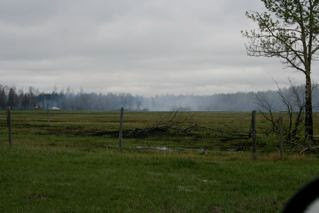
I hiked back into portions of the burn area on Saturday morning. The pictures I took are part of this update.
There are areas that I was not allowed into as the firefighting efforts are ongoing. In the areas that I did get into, the damage is overwhelming. At one spot in a three to four hundred acre bog, if you turn 360 degrees, everything in sight is black or scorched beyond recovery.
The Opal Natural Area (east) consisting of 631 acres has been blackened end to end. From what I could see, well over 2000 acres of the grazing lease was burnt. An undetermined amount of private land was also burned over.
The good news is that Opal Natural Area (west) and its PNT consisting of approximately 960 acres was largely untouched. West of where the firefighters held the line an area of 4000 acres of bog, heavy pine and spruce forest was left intact. This area (about half of it private land) is in Sturgeon or right on the boundary with Sturgeon.
I had a chance to talk with several of the local residents. They have been justifiably spooked by this wildfire. They are happy that the firefighters are working from the fire's edge back into the burned area. They are however, keenly aware that with a few warm and sunny days the fire risk will become once again very high. The woods are extremely dry.
Here are a few pictures that I took with some commentary.
#1) There are 8 access points to the Opal Natural Area and grazing leases. 5 of them connect directly to Sturgeon County. The tracks seen here have been made since the fire and the rain and are in a bog that has filled the track with water.
#3) An extensive bog (approximately 200 acres) immediately adjacent to the location of picture #2. Should a fire get started here, it would spread to a large spruce area represented by picture 4.
#4) Large spruce area
#5) This is what a peat bog looks like before a fire.
#6) This is what a peat bog looks like after a fire complete with tuft of smoke still burning.
#7) This is as close as I could get to around 80 acres of burning peat bog. While I was there, a huge back hoe appeared to be digging a moat around the perimeter of the bog.
#8) This picture shows a section of approximately 15 kms of fireguard cut through the forest. This looks pretty much like a future site for quad traffic. Definitely necessary but an unfortunate result of a fire that was started by an ATV.


No comments:
Post a Comment